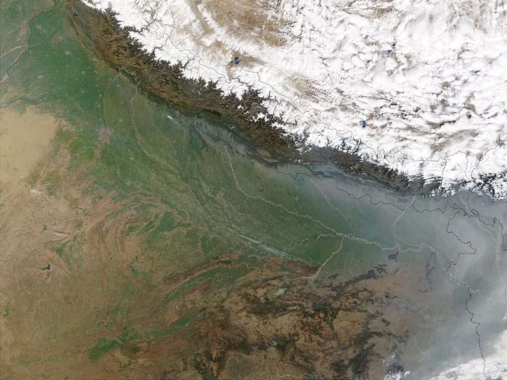
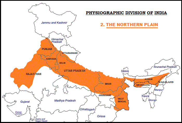
North Plains of India: The northern plain is shaped by the confluence of three major river systems, the Indus, Ganga, and Brahmaputra, as well as their tributaries. This plain has an extent of 7 lakh square kilometres.
The plain, which stretches for around 2400 kilometres and is 240 to 320 kilometres wide, is a densely inhabited physiographic division. It is an agriculturally productive portion of India, with a rich soil cover, enough water supply, and a favourable climate.
Principal Characteristics
Three river systems, the Indus, the Ganga, and the Brahmaputra, as well as their tributaries, make up India’s northern plain.
The northern plains are the world’s largest alluvial expanse. From west to east, these plains stretch for over 3200 kilometres.
The plains’ typical breadth varies between 150 and 300 kilometres. The width of the northern plains rises from east to west in general (90-100km in Assam to about 500km in Punjab).
The precise depth of alluvium has yet to be determined. According to contemporary estimations, the average depth of alluvium on the southern side of the plain ranges from 1300-1400m, whereas the depth of alluvium increases as you approach the Shiwaliks. In places of Haryana, maximum depths of above 8000m have been attained.

The monotonous plain’s main trait is its considerable horizontality (200m – 291m). Near Ambala, the highest point is 291 metres above sea level, forming a watershed between the Indus and Ganga systems.
River bluffs, levees, and other features of the physical landscape break up the monotony.
Floodplain – The area of a river valley adjacent to the channel through which water rushes during a flood.
Levee – An elevated bank surrounding the river’s course and rising above the flood plain’s level.
A river-cut cliff or steep slope on the outside of a meander is known as a bluff. The edge of a previous floodplain is often marked by a line of bluffs.
Physiographic Divisions of Great Plains of India
There are three primary physiographic divisions in the northern plains:
- The Bhabar
- The Tarai
- The Alluvial Plains
Let us now look at the main characteristics of each of the aforementioned divisions.
The Bhabar
- The Bhabar belt is around 8-10 kilometres long and runs east-west.
- In comparison to the western side, the east side of this split is narrow.
- This 8-10 kilometre long band stretches from the Indus River in the west to the Teesta River in the east.
- This division is made up of high-intensity coarse rocks and pebbles.
- The majority of the area beneath this terrain is dry, with light to medium rainfall.
- Crop cultivation is not suitable for it.
The Tarai
- Tarai, to the south of Bhabar, is a mash land.
- Its width varies between 10 and 20 kilometres.
- The Tarai division, unlike Bhabar, is dense in the eastern half, where the river Brahamapura receives a lot of rain every year.
- It contains some Bhabar division underground streams.
- The majority of the states in this region, like Uttar Pradesh, Punjab, and Uttarakhand, are used for farming.
The Alluvial Plains
The alluvial plains are separated further into two types:
a. The Bhangar
- Alluvial soil deposits with a dark colour, large hummus, and production potential.
- The Bhangar soil is clay-based and high in lime.
- The Bhur formations along the Ganga and Yamuna rivers, and the Barind plains in the Bengal delta, are two regional variations.
- Minor residues of alkaline and saline efflorescence, known as khallar, bhur, and reh, make up this substance.
- There are also the remains of extinct flora and animals in this area.
b. The Khadar
- Flood plains with extensive alluvium deposits are sometimes referred to as flood plains.
- The Khadar has a porous texture, is pale in colour, and has a sandy texture.
- The Ganga region has the most productive soil belt of them all.
- In Punjab, they are referred to as Betlands or Bets.
- Between Punjab and Haryana, there are tiny rivers where this species can be found. Dhayas is the name given to the khadar division in this region.
- These Days are roughly 3 metres above sea level.
Great North Indian Plains Climate
A continental climate prevails on the Great North Indian Plains. By the name continent, it is meant that the majority of the states in this belt are subjected to harsh climatic conditions.
As a result, states like Delhi, Haryana, Punjab, and Uttar Pradesh are scorching hot in the summer and cold in the winter.
The Importance of the Great Indian Plains
- The massive concentration of people in rural and urban areas
- Has enormous political, cultural, and economic clout.
- India’s national capital, Delhi, is situated on the northern plains.
- These grasslands were the birthplace of Aryavata civilizations (the epics of Ramayana and Mahabharata took place in this region)
- Observed significant Indian civilizations such as Lothal, Harappan, and Mohenjodaro, among others.
- Mathura, Vrindavan, Ayodhya, and other sacred pilgrimage places are included.
- These plains cultivate over 60% of India’s food production, with a population of around 65 crores.


